


RYE TWP Voting District, Perry County, Pennsylvania
About
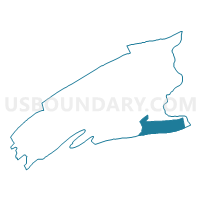
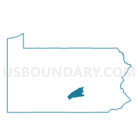
Outline

Summary
| Unique Area Identifier | 661966 |
| Name | RYE TWP Voting District |
| County | Perry County |
| State | Pennsylvania |
| Area (square miles) | 25.73 |
| Land Area (square miles) | 25.72 |
| Water Area (square miles) | 0.01 |
| % of Land Area | 99.96 |
| % of Water Area | 0.04 |
| Latitude of the Internal Point | 40.32460130 |
| Longtitude of the Internal Point | -77.04182210 |
Maps

Graphs
Select a template below for downloading or customizing gragh for RYE TWP Voting District, Perry County, Pennsylvania


Neighbors
Neighoring Voting District (by Name) Neighboring Voting District on the Map
- CARROLL TWP Voting District, Perry County, PA
- EAST PENNSBORO TWP PCT 10, Cumberland County, PA
- HAMPDEN TWP PCT 12, Cumberland County, PA
- MARYSVILLE Voting District, Perry County, PA
- MIDDLESEX TWP PCT 1, Cumberland County, PA
- PENN TWP Voting District, Perry County, PA
- SILVER SPRING TWP PCT 01 ED NORTH, Cumberland County, PA
- SILVER SPRING TWP PCT 02, Cumberland County, PA
- WHEATFIELD TWP Voting District, Perry County, PA
Top 10 Neighboring County Subdivision (by Population) Neighboring County Subdivision on the Map
- Hampden township, Cumberland County, PA (28,044)
- East Pennsboro township, Cumberland County, PA (20,228)
- Silver Spring township, Cumberland County, PA (13,657)
- Middlesex township, Cumberland County, PA (7,040)
- Carroll township, Perry County, PA (5,269)
- Wheatfield township, Perry County, PA (3,334)
- Penn township, Perry County, PA (3,225)
- Marysville borough, Perry County, PA (2,534)
- Rye township, Perry County, PA (2,364)
Top 10 Neighboring Place (by Population) Neighboring Place on the Map
Top 10 Neighboring Unified School District (by Population) Neighboring Unified School District on the Map
- Cumberland Valley School District, PA (54,564)
- East Pennsboro Area School District, PA (20,228)
- West Perry School District, PA (18,994)
- Susquenita School District, PA (14,612)
Top 10 Neighboring State Legislative District Lower Chamber (by Population) Neighboring State Legislative District Lower Chamber on the Map
- State House District 87, PA (71,639)
- State House District 86, PA (66,211)
- State House District 199, PA (65,380)
Top 10 Neighboring State Legislative District Upper Chamber (by Population) Neighboring State Legislative District Upper Chamber on the Map
Top 10 Neighboring 111th Congressional District (by Population) Neighboring 111th Congressional District on the Map
- Congressional District 19, PA (728,630)
- Congressional District 17, PA (681,835)
- Congressional District 9, PA (666,810)
Top 10 Neighboring Census Tract (by Population) Neighboring Census Tract on the Map
- Census Tract 118.01, Cumberland County, PA (7,739)
- Census Tract 118.03, Cumberland County, PA (7,040)
- Census Tract 305.01, Perry County, PA (5,269)
- Census Tract 102.01, Cumberland County, PA (5,162)
- Census Tract 304, Perry County, PA (4,898)
- Census Tract 303.01, Perry County, PA (4,747)
- Census Tract 303.02, Perry County, PA (4,728)
- Census Tract 113.01, Cumberland County, PA (4,474)
Top 10 Neighboring 5-Digit ZIP Code Tabulation Area (by Population) Neighboring 5-Digit ZIP Code Tabulation Area on the Map
- 17013, PA (34,575)
- 17015, PA (20,798)
- 17025, PA (16,778)
- 17020, PA (9,047)
- 17090, PA (5,216)
- 17053, PA (5,001)